
Curly-leaf Pondweed Key Points
Curly-leaf Pondweed (CLPW) is a cold-hardy invasive aquatic plant that grows slowly beneath the ice throughout the winter and reaches peak growth in May and June. Most CLPW is found in 7-8 feet of water, however, there are some cases of a few scattered plants found as deep as 18 ft.
Curly-leaf Pondweed Timeline
When we first discovered rooted CLPW in North Pond in 2024, large, dense patches had already formed by mid-May—while most native aquatic plants were just emerging from winter dormancy. This early growth strategy allows CLPW to monopolize valuable space and resources, crowding out native species and creating cascading impacts for fish and wildlife. For these reasons, early spring removal is critical to prevent the formation of dense monocultures that harm native biodiversity.
We are still in the early stages of understanding this infestation. In 2024, we observed a period of seasonal dormancy from mid-June through August, which coincided with a significant lake-wide algae bloom. In contrast, no such dormancy was observed in 2025, and CLPW appeared to grow throughout much of North Pond. With only two years of active management, there is still much to learn. What remains certain, however, is that 7 Lakes Alliance divers will continue working diligently to locate and remove this noxious species in order to protect North Pond.
In 2025, North Pond Association volunteers, anglers, and property owners played a vital role by keeping watchful eyes on the lake and deploying marker buoys to flag suspected CLPW. Their efforts allowed 7 Lakes divers to respond quickly to new sightings—our most effective strategy for limiting spread and reducing ecological impact.
Identification Tips and Timeline
2026 Remediation Updates
Beginning in spring 2026, the 7 Lakes Alliance dive crew will return to the water and continue remediation work through the end of October. You can expect to see them on the lake Monday through Thursday, with additional group paddles co-hosted with the North Pond Association on select summer weekends.
Inland Fisheries and Wildlife and the Department of Environmental Protection approved three small surface-use restrictions (SUR) in North Pond from now till December 31st 2026. These restrictions will protect 7 Lakes Alliance divers while they work to remove invasive plants from North Pond and will help limit the spread of those plants. The SURs will be marked with large buoys, similar to the white and orange hazard buoys you see near rocks.
What to know about North Pond Surface Use Restrictions
● Restrictions are in place to protect working divers and curly-leaf pondweed survey volunteers.
● 100 foot buffers are in place to make sure property owners can get in and out.
● The SUR does not cross the channel going into Little North Pond.
● The total restricted areas (25.7 acres) is only 1.15% of North Pond (2,225 acres), meaning approximately 99% of North Pond is available for recreation.
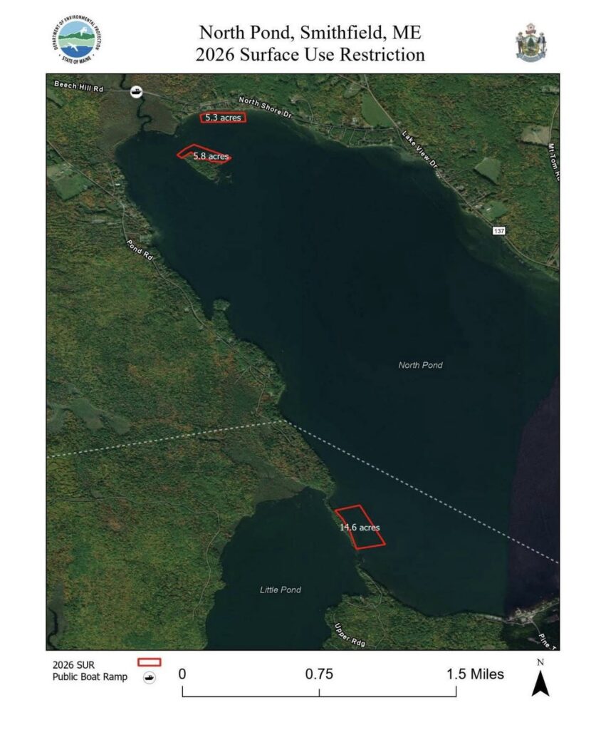
SUR map created by Inland Fisheries and Wildlife and the Department of Environmental Protection
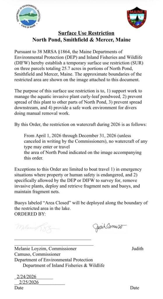
Letter issued by Inland Fisheries and Wildlife and the Department of Environmental Protection
FAQ
What is a surface use restriction (SUR)?
SURs are temporary restrictions prohibiting boats (motorized and paddle) from entering an area for a period of time. In the case of North Pond, the SURs are in areas with the most CLPW density and are intended to:
- limit the spread of CLPW from fragmentation
- protect our divers at work
Why are these restrictions in place?
Restrictions are in place to protect working divers and curly-leaf pondweed survey volunteers.
What about the private properties near the SURs?
There are no homes or camps affected by the SURs next to Pomleau Island or near the entrance to Little Pond. The SUR abutting North Shore Drive has a 100 foot buffer from shore to the SUR buoys, so property owners can safely navigate from shore to the lake. Most curly-leaf pondweed has been found 100-300 feet from shore. The SURs are positioned in those areas, where most curly-leaf has been previously found.
Why these locations?
- While CLPW has been found at low densities throughout North Pond, the three areas with SURs are where it is most concentrated.
- Keeping all boats out of the concentrated areas is the best shot we have at minimizing spread within the lake, and outside the lake.
- The SUR does not cross the channel going into Little North Pond.
- The total restricted areas (25.7 acres) is only 1.15% of North Pond (2,225 acres), meaning approximately 99% of North Pond is available for recreation.
If CLPW is scattered around everywhere, why do we need these SURs?
- While CLPW has been found at low densities throughout North Pond, the three areas with SURs are where it is most concentrated.
- Keeping all boats out of the concentrated areas is the best shot we have at minimizing spread within the lake, and outside the lake.
- For the past two years, there have been numerous occasions where boats have gotten dangerously close to our divers. This is with having diver-down flags on the dive vessel and brightly colored buoys marking CLPW. Without restrictions, it is only a matter of time that someone is injured. Let’s not forget that a marked diver was struck by a boat a few years ago in North Pond.